[ad_1]
In the foothills of the Himalayas, where the ancient Yarlung civilisation established the first Tibetan Empire, China has plans to build the world’s biggest hydroelectric dam.
In November of last year, China’s state-owned media shared plans for a 60-gigawatt mega-dam on the Yarlung Tsangpo river in the Tibetan Autonomous Region (TAR).
Now with the aim of achieving carbon neutrality by 2060, Beijing has redoubled its efforts on its hydropower projects in Tibet, even though the dams have drawn criticism from Tibetan rights groups and environmentalists.
Tenzin Dolmey has never stepped foot on the Tibetan Plateau, but she was brought up with the stories of the great rivers and mountains, which form her ancestral home.
“Respect for nature is so deep-rooted,” said Dolmey, who was brought up among Tibetan exiles in India and now teaches Tibetan language and culture in Melbourne, Australia’s second-biggest city.
“When we would swim in the rivers, we were told to never use it as a bathroom, because there are river gods in the water.”
The Yarlung Tsangpo is of particular significance, as it represents the body of the goddess Dorje Phagmo, one of the highest incarnations in Tibetan culture.
Tempa Gyaltsen Zamlha, the head of Environment and Development at the Tibetan Policy Institute, says this reverence for the natural world was born from the Tibetan Plateau’s unique landscape and dates back centuries.
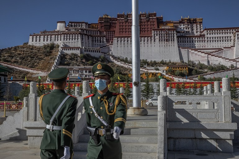
 China took control of Tibet in 1950 and has invested billions in developing highways, railways and other infrastructure. Tibetans worry about the effect of such projects on their unique landscape and way of life [File: Roman Pilipey/EPA]
But since China, controlled by the Communist Party (CCP), annexed Tibet in 1950, Zamlha says Tibetans have lost all say in what happens on their land.
“We had absolutely no dams before Chinese occupation, not because we were not able to harness it, but because we had immense respect for the nature of the rivers,” he told Al Jazeera.
“There’s a very strict tradition that no one will go near certain streams or do anything that would disturb it. You don’t even need laws – every Tibetan abides by it.
“The Chinese will do anything to benefit their growth and this is very frustrating because Tibetans are not consulted.”
World’s highest river
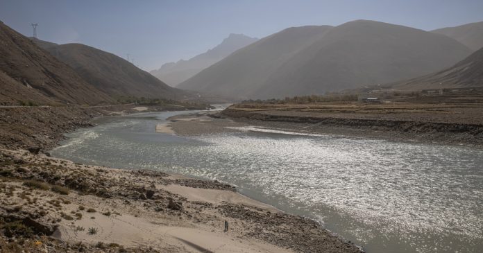
From its origin in the glaciers of western Tibet, the Yarlung Tsangpo reaches heights of nearly 5,000 metres (16,404 feet) above sea level, making it the highest river in the world as it snakes its way through the Himalayan mountain range.
The river plunges 2,700 metres (8,858 feet) through what is known as the Yarlung Tsangpo Grand Canyon, forming a gorge more than twice the depth of the Grand Canyon in the United States.
The precipitous fall makes it particularly conducive to collecting hydroelectric power but experts have warned the record-breaking dam is likely to have political and environmental consequences.
According to the Power Construction Corp of China’s chairman, Yan Zhiyong, the mega-dam’s has primarily been constructed to power China’s green future.
While China already has an excess of energy, Brian Eyler, an expert in rivers who is the director of the South East Asia Program at the Stimson Center, says the power generated will probably be used to cover losses as it makes the transition from fossil fuels to cleaner energy.
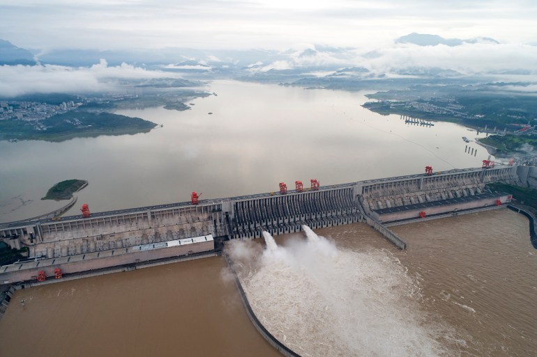
The mega-dam could produce as much as three times the hydroelectric power of China’s current largest dam, the Three Gorges, a project which forced the relocation of more than 1.4 million people.
 The Three Gorges Dam on the Yangtze River in central China is currently the world’s biggest dam. The dam on the Yarlung Tsangpo would be even bigger [File: Wang Gang/Xinhua via AP Photo]
The areas surrounding the Yarlung Tsangpo are less densely populated than the Yangtze River.
But there is a precedent for the relocation of the local residents to make way for dam projects on the Yarlung Tsangpo, with local media reporting nearly 2,000 people were moved for the construction of the Yagen Hydropower Station in 2015.
According to the state-backed Global Times newspaper, the Yarlung Tsangpo dam will be built in Medog County, which has a population of 14,000 people.
Al Jazeera approached the Power Construction Corp of China for comment on the number of people who will be affected by the Yarlung Tsangpo dam but did not receive a reply.
Geopolitical significance
Spread across 2.5 million square kilometres (8.2 million square miles), the Tibetan Plateau is rich in natural resources and borders several other nations.
The freshwater runoff, which comes from melting glaciers and mountain springs, flows down through the Himalayan watershed and provides drinking water to an estimated 1.8 billion people in countries including China, India and Bhutan.
Zamlha believes Tibet’s resources such as the Yarlung Tsangpo and Mekong rivers were a key factor in the CCP’s decision to take control of Tibet more than 70 years ago.
Those geopolitical factors were brought into sharp focus last year following a dispute in the western Himalayas between India and China, in which 20 Indian troops and an unknown number of Chinese were killed. It emerged last month that soldiers had brawled again along their shared border.
After leaving China, the Yarlung Tsangpo flows into Bangladesh and the Indian states of Arunachal Pradesh and Assam, where the river is referred to as the Brahmaputra.
With the proposed mega-dam sited just 30 kilometres (18 miles) from the Indian border, Zamlha believes the CCP will “definitely try to use it as a political tool”.
A spokesperson for India’s ministry in charge of managing its water resources said it would respond with a 10-gigawatt project on another tributary of the Brahmaputra.
 The Yarlung Zangbo flows into India where it is known as the Brahmaputra and supports thousands of fishing communities along its banks [File: Anupam Nath/AP Photo]
Sensing the potential for conflict, the United States has tried to prod the two sides into resource-sharing.
The Tibet Policy and Support Act, recently signed into law by Congress, outlined a commitment to: “encourage a regional framework on water security… to facilitate cooperative agreements among all riparian nations … on the Tibetan Plateau.”
Likewise, the International Water Courses Convention, adopted by the United Nations in 1997, applies certain rights and duties in relation to trans-boundary flows, although neither Bangladesh, India or China are signatories.
China has tried to allay these concerns. In a statement in December, Hua Chunying, a spokesperson for the Chinese Foreign Ministry said: “China will continue to maintain communication with India and Bangladesh through existing channels. There is no need for the outside world to over-interpret it.”
Lessons from the Mekong
While the project in the Yarlung Tsangpo Grand Canyon will certainly be the largest, it is not the only dam project along the river.
Several small- and medium-sized dams have already been built, according to the Stimson Center’s Eyler.
An authority on the Mekong River, he is worried the Yarlung Tsangpo could pave the way for the emergence of similar projects.
Analysis of recent data on Chinese dams has found “these operations have delivered deeper and deeper cuts to the downstream communities of the once-mighty Mekong river,” he said.
He notes that the “zero coordination for operating dams” has allowed China’s 11 Mekong dams to disrupt fish life and the flow sediment and has directly contributed to the collapse of river banks and the destruction of communities.
While the specifics of China’s development plans for the Yarlung Tsangpo remain blurry, Eyler says there are huge risks.
“Rivers are known to be hungry,” Eyler said.
“So you take that sediment out and that hungry river starts looking for new stuff, and it’s gonna pull it off of the banks and cause the deltas to erode. It’s a natural process caused by something unnatural.”
By damming the Yarlung Tsangpo’s Grand Canyon, another source of Tibetan identity will be permanently altered.
Tenzin Dolmey holds onto the hope that one day she will see Tibet for herself. But after living 34 years away from her homeland, life as a Tibetan in exile has taught Dolmey to limit her expectations.
“I always had this vision of the beautiful capital of Lhasa,” she said.
“But I know it will be like nothing close to my dreams.”
[ad_2]
Source link


